
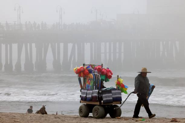
You check your phone in the morning and plan a beach day. By lunch, Santa Monica is socked in, but the Valley is grilling the sidewalks. Same day, same county, totally different sky. That is not your app being flaky. It is the city’s geography and a handful of repeatable patterns that make Los Angeles weather feel like it never quite behaves.
A quick picture of the split helps. The official 1991–2020 climate normals put the Santa Monica Pier’s typical July afternoon high near 69.4°F, while Downtown at the USC station it is closer to 82°F. That is an everyday 10 degrees plus created by cold coastal water and hills that block or funnel wind. If you only look at “Los Angeles,” you miss the fact that Westside, Basin, and Valleys act like separate cities with separate seasons.
There is also some inside-baseball in how numbers get reported. On May 20, 2024, the official Downtown Los Angeles observing site moved from the USC campus to the Los Angeles Fire Department’s Frank Hotchkin Memorial Training Center in Elysian Park. If a rainfall average or “record” you remember suddenly does not line up, a station move like that is often why. The normal Downtown season total is still about 14.25 inches using the 1991–2020 period, but any single storm’s totals may read a little differently than they used to because the instruments now sit on a different hill.
What coastal Angelenos call May Gray and June Gloom is the marine layer doing its job. Cold upwelling hugs the shoreline and a shallow layer of stratus drifts inland overnight. It can hang at the beaches right through lunchtime while sun breaks out over Mid City and downtown, and by midafternoon the San Fernando and San Gabriel valleys are baking.
If you want a quick reality check before you pick a sweater or a sun hat, the aviation weather observations at the core LA airports are your best free thermometer. Reports known as METAR come out at least hourly and more often when conditions are changing. Look at KLAX for the beaches, KSMO for Santa Monica, KBUR for Burbank, KVNY for Van Nuys, and KLGB for Long Beach. Pilots read these strings all day because they are standardized and current. You can, too.
Summer heat running you out of the flats? The San Gabriels flip the script in minutes. Drive up to Mount Wilson and the air is commonly cooler, and the wind is often a different direction from the Basin. The observatory at 5715 feet posts a simple reminder: conditions up there shift fast and can swing to dense fog or even snow in winter. It is open most of the year to casual visitors 10 a.m.–4 p.m., with guided weekend walking tours in season at 11:30 a.m. and 1 p.m. Tickets are sold at the Cosmic Cafe for $20 adults and $15 for ages 12 and under and 62 and up. The Cosmic Cafe itself serves on weekends roughly April to December, so you can plan a windbreak and a sandwich along with your sky check.
Down at the beach, how much the low clouds matter depends on what you intend to do and where you plan to park. County-operated lots publish set prices by hour block and season. For example, at Venice’s Washington Boulevard lot, summer weekend daytime parking from 8 a.m.–6 p.m. is typically $18, while the evening window 6–10 p.m. is $9. At White Point/Royal Palms in San Pedro, winter daytime can run $10 in the lower lot and the upper meters post $0.25 per 10 minutes on weekends. Will Rogers State Beach’s Lot 3 at 15800 Pacific Coast Highway is listed as open 6 a.m.–10 p.m. These are the kinds of little details that control whether a marine-layer gamble feels like a win or a parking-ticket loss.
When the local coast wind field develops a small counterclockwise swirl, forecasters call it a Catalina eddy. It deepens the night and morning marine layer and pushes low clouds farther into the Basin than a typical sea breeze would. Forecasts that look sunny at daybreak can lean hazy by midmorning when an eddy spins up. You will see the local forecast discussion actually say “eddy” when it is in play. If a June weekend suddenly runs shades-and-sweater instead of beach blanket, that is usually the culprit.
From roughly autumn through early spring, high pressure inland sometimes drives very dry air out of the deserts, over the passes, and into the county from the northeast. Those are Santa Ana winds. They are a cool-season pattern that peaks most often in December and January, but they can show up from September into April. Two things matter for your day: the air is extremely dry, so temperatures jump quickly with sun, and the usual ocean breeze can be shoved offshore. That is why you can get your hottest coastal afternoons of the year in October instead of July.
Santa Anas are also the reason TV and phone alerts get loud about fire weather. Dry wind over foothills lined with canyons equals fast spread if ignition happens. A famous example of what prolonged heat can look like on the other side of the calendar is the 121°F all-time high reached in Woodland Hills on September 6, 2020. You will not see that in January, but the October to April window brings the days where warm downslope wind means you feel desert air at the beach.
Every few weeks in the cool season a slow, disorganized low pressure system can drift over Southern California from the Pacific. These “cutoffs” wobble, feed on pockets of moisture, and can spit out showers at odd hours that smaller forecast icons do not capture neatly. When your app shows a low chance of precipitation with nothing else obvious going on, that is often the setup. It is also why seasoned Angelenos keep a light jacket in the trunk twelve months a year.
Whenever there is significant rainfall, the Los Angeles County Department of Public Health issues a countywide ocean water quality rain advisory. The guidance is to avoid ocean water contact for at least 72 hours after rain ends, especially near storm drains, creeks, and rivers. That is not a vibes-based caution. Runoff sends bacteria into the surf zone, and levels can take days to drop. If you surf, swim, or bring kids to splash along the shore, those advisories are the one weather-adjacent notice you should always treat as a plan-changer.
You have a few options that consistently help in Los Angeles. One is the local National Weather Service office in Oxnard. That office issues forecasts for Los Angeles, Ventura, Santa Barbara, and San Luis Obispo counties and the adjacent coastal waters out 60 nautical miles. The text-based forecast discussion there explains why the numbers are what they are. If you see “eddy” or “gusty NE winds below passes and canyons,” you know which pattern is steering the day.
Another option is a local station’s weather app or site. Pick one that shows radar and hourly changes by city rather than a single dot for “Los Angeles.” ABC7 uses the AccuWeather system on its weather pages. NBC4 brands its coverage as First Alert and maintains a dedicated weather app with push alerts and live radar. KTLA 5’s app posts an interactive radar, daily and hourly breakdowns, and can alert you for lightning or heavy rain in your saved locations. Spectrum News 1 provides hyperlocal updates on channel 1 for Spectrum TV customers and inside the Spectrum TV and Spectrum News apps.
When you want to sanity-check an hourly forecast against reality at your exact corner of the county, those METAR airport observations are the shortest path between “maybe” and “what is actually happening now.” They are standardized, updated at least hourly, and posted for KLAX (coast), KSMO (coast), KBUR and KVNY (valley), and KLGB (southeast LA County). On days the marine layer is stubborn, a glance at KLAX or KSMO tells you if stratus is thick and how the wind is behaving. On hot, hazy afternoons, a quick look at KBUR and KVNY shows you how warm the inland basins really got.
| Source | How to access | What it is good at | Cost or access note |
| National Weather Service Los Angeles/Oxnard | Forecast pages and the daily “forecast discussion” | Explains patterns driving the numbers, covers LA, Ventura, Santa Barbara, SLO counties and coastal waters | Free |
| ABC7 Los Angeles (KABC) | Weather pages and free mobile app with AccuWeather branding | City-by-city microclimate forecasts and regional radar in a simple layout | Free |
| NBC4 (KNBC) | First Alert weather site and NBC4 weather app | Live radar, push alerts for severe or high-impact days, bilingual coverage alongside Telemundo 52 | Free |
| KTLA 5 | KTLA 5 app | Interactive radar, quick hourly changes, frequent morning updates | Free |
| Spectrum News 1 | Channel 1 on Spectrum TV and Spectrum apps | Neighborhood-level updates and live coverage that follows microclimate shifts | Included for Spectrum TV customers |
Two more local checks are useful and inexpensive. First, if you want to see the marine layer or clearing in person without committing to a full beach day, the Griffith Observatory sits above the Basin with public terraces and exhibits. Admission is free. The building is normally open 12 p.m.–10 p.m. Tuesday–Friday and 10 a.m.–10 p.m. Saturday–Sunday, closed Mondays. If skies cooperate, the Samuel Oschin Planetarium sells on-site show tickets that day only: $12 for adults, $10 for seniors, students, and teachers, and $8 for kids 5–12. Second, if your plans point you up the Angeles Crest, most parking areas in the Angeles National Forest require a USFS Adventure Pass: $5 for a day or $30 for an annual pass, valid across the Southern California national forests. It is a small fee that saves a headache if you end up chasing cooler mountain air.
If you want to see how Los Angeles weather really works, pair a forecast with a simple field trip loop.
Start at the coast early. On May–June mornings, the marine layer can keep the Westside gray until midday. Santa Monica stays classically cool, but if you head a few miles south into Venice there are finer-grain differences hour by hour. The County’s fee schedule shows how to time it without overpaying: at the Venice Washington Boulevard lot, $18 covers the summer weekend daytime window, while the late window after 6 p.m. drops to $9. If the afternoon finally clears, Will Rogers State Beach’s Lot 3 at 15800 PCH runs 6 a.m.–10 p.m. and sits far enough north to catch a lighter crowd on socked-in days.
Then climb a bit. Griffith Observatory’s lawn and terraces show the exact edge where low clouds thin into bright sun. It also gives you a read on the wind. If trees on the ridge are still, the sea breeze is weak and inland neighborhoods will heat more quickly. Admission to the building and grounds is always free, so your only cost on a recon stop is time, and the hours leave you room after work most of the year.
Finally, if heat is the problem, take the mountains. Mount Wilson’s museum and 100-inch viewing gallery are listed free during open hours, and weekend docent tours are $20 for adults and $15 for seniors and kids 12 and under. The site’s own note about weather is a good rule of thumb: mountain conditions can be very different from the city below, so bring a layer even on days the Basin feels like a hair dryer. Parking up there falls under the Adventure Pass rule, so plan to pick up a day pass on the way if you do not already have the annual.
If the ocean is your weather hobby, the Cabrillo Marine Aquarium in San Pedro gives you a local read on tidepool and nearshore life right where the sea breeze and the harbor meet. General admission is free year‑round, with a suggested donation of $10 for adults and $5 for children and seniors. Hours vary by season, and many programs book around low tide, so it is a handy stop when you want to understand why a light morning drizzle sometimes comes with a stiff afternoon wind across the harbor entrance.
Cold coastal water builds a shallow marine layer that slides inland overnight. It can hold at the shore well into midday while sun breaks the clouds inland. The normals show the split clearly, with the Santa Monica Pier’s July high near 69.4°F versus Downtown’s 82°F, so your beach and Basin hours behave differently even on the same day.
It is a small counterclockwise swirl in the coastal wind field that deepens and pushes the marine layer farther inland. When it spins up, late‑morning clearing delays and the beaches can stay gray while valleys warm. Local forecasts will call out the eddy in the discussion when it is driving that behavior.
Santa Ana winds blow from the inland deserts toward the coast, mainly between fall and early spring. The forecast discussion often says “NE winds below passes and canyons.” On those days the usual onshore breeze weakens, humidity drops fast, and coast neighborhoods heat more than a summer sea‑breeze day.
County health officials advise staying out of the ocean for 72 hours after significant rainfall. Runoff raises bacteria levels near storm drains, creeks, and river mouths. Those advisories are issued frequently in wet months and apply to all LA County beaches until they expire.
When plans hinge on the sky, think like a local producer. Pull a discussion from Oxnard, glance at the nearest METAR, and decide which side of the hills fits the day. If you are still torn, keep the drive short: a free hour at Griffith can tell you more about the next six than any single icon on a screen.
Published: September 9, 2026